The portfolio and blog of David Bennett

Category: Mapping (Page 3 of 3)

Mapping Monday: Psi World and Dystopias

Psi World cover

Despite the sparsity of the rules and the limitations of the setting, the Psi World game was a great jumping-off point for a dystopian future built around psionic powers. The campaign I began developing was based on the game materials with a cyberpunk dystopian near-future setting, but centered around those with psionic abilities who, rather than merely being outcasts like hackers and rebels in such a setting, were instead forced to live on the fringes or to hide out due to their very nature.

Continue reading

Mapping Monday: My Gamma World Campaign – Detail Maps

As mentioned in my previous post about a long-running Gamma World campaign, the maps increasingly became more detailed and linear to meet the needs of the game. This set of maps was pretty much the second phase of the campaign after the players had confronted the threat posed by the Unclean and turned their attention to the lands inhabited by the Death Groups, a combination of the nomadic aspects of the Red Death cryptic alliance (thus the name, but with the extermism subsumed by the group known as the Seekers of the Red Sword) and the willingness to live in radioactive areas like the Radioactivists (and thus having access to higher technology, like the Unclean, but with less infrastructure to take advantage of it, due to their nomadic society).
Continue reading

Park Maps in the Style of Tolkien

The beauty of a good map is that it can be lifted from anywhere and used as an adventure setting for a game with minimal modification. I leanred this lesson early with a gamemaster who used a detailed topographical map of a section of bayou for an adventure that involved the party being pursued in boats by the angry natives who lived there. As waterborne adventures went, it was a blast, event though it did result in a total party kill (TPK). But the map really worked because the features were interesting and varied, but without recognizable landmarks that would have jarred the illusion.

If you’re a fan of J.R.R. Tolkien’s style of mapmaking, you should definitely consider the national park maps of Dan Bell. Not only are his stylized maps fun representations of real-world parks, their style readily lends their use to a game or simply as beautiful art for your walls.

Lake District National Park by Dan Bell

Mapping Monday: My Gamma World Campaign – Mapping the World

Hiero’s Journey and The Unforsaken Hiero

One of the longest running campaigns I’ve ever run was a Gamma World game based on the original first edition rules. In building the world, I used not only elements from the setting sketched out in the book, but elements from other game settings like The Morrow Project and Aftermath along with ideas from film and fiction. The most direct lift was the territory controlled by the Eleveners, a direct lift from Hiero’s Journey by Sterling E. Lanier and its sequel, though the actual details of their society included elements from Miller’s A Canticle for Liebowitz and was a combination of Healers and Restorationists as presented as Cryptic Alliances in the setting. Lifewise, the Brotherhood of the Unclean became simply The Unclean as the dark side to the Restorationists with a healthy dose of other antagonists thrown in including, most predominantly, Radioactivists.

Continue reading

Mapping Monday: Designer Pete Fenlon

The maps of Middle Earth have always held a special place with me, whether it’s been the original maps by J.R.R. Tolkien himself, the version by Pauline Baynes from the calendar that I owned once upon a time, or the detailed maps by Karen Wynn Fonstad that appeared in her Atlas of Middle Earth. The idea of a world with depth and history is always appealing and I must have explored every corner of the world, not only following the path of the Fellowship, but also the places mentioned in the stories or shown on the maps that were peripheral to the saga.

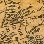
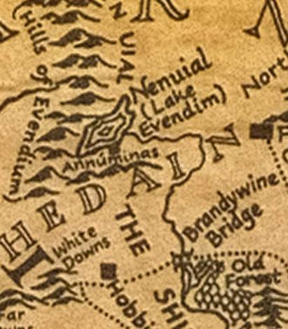
Lake Evendim and surrounds from the map by J.R.R. Tolkien

Of particular note was the lost kingdom of Arnor and the remains of its capital city, Annúminas, on the southern shore of Nenuial, also known as Lake Evendim. This is, without a doubt, my single most favorite place in Middle Earth. As the ruins of a once-great city, it barely merits a footnote in the story apart from being a special place to the Rangers of the North, the descendents of the northern Dúnedain.

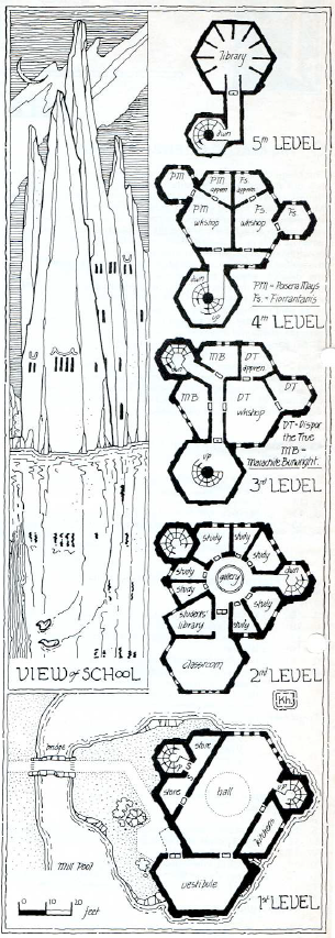
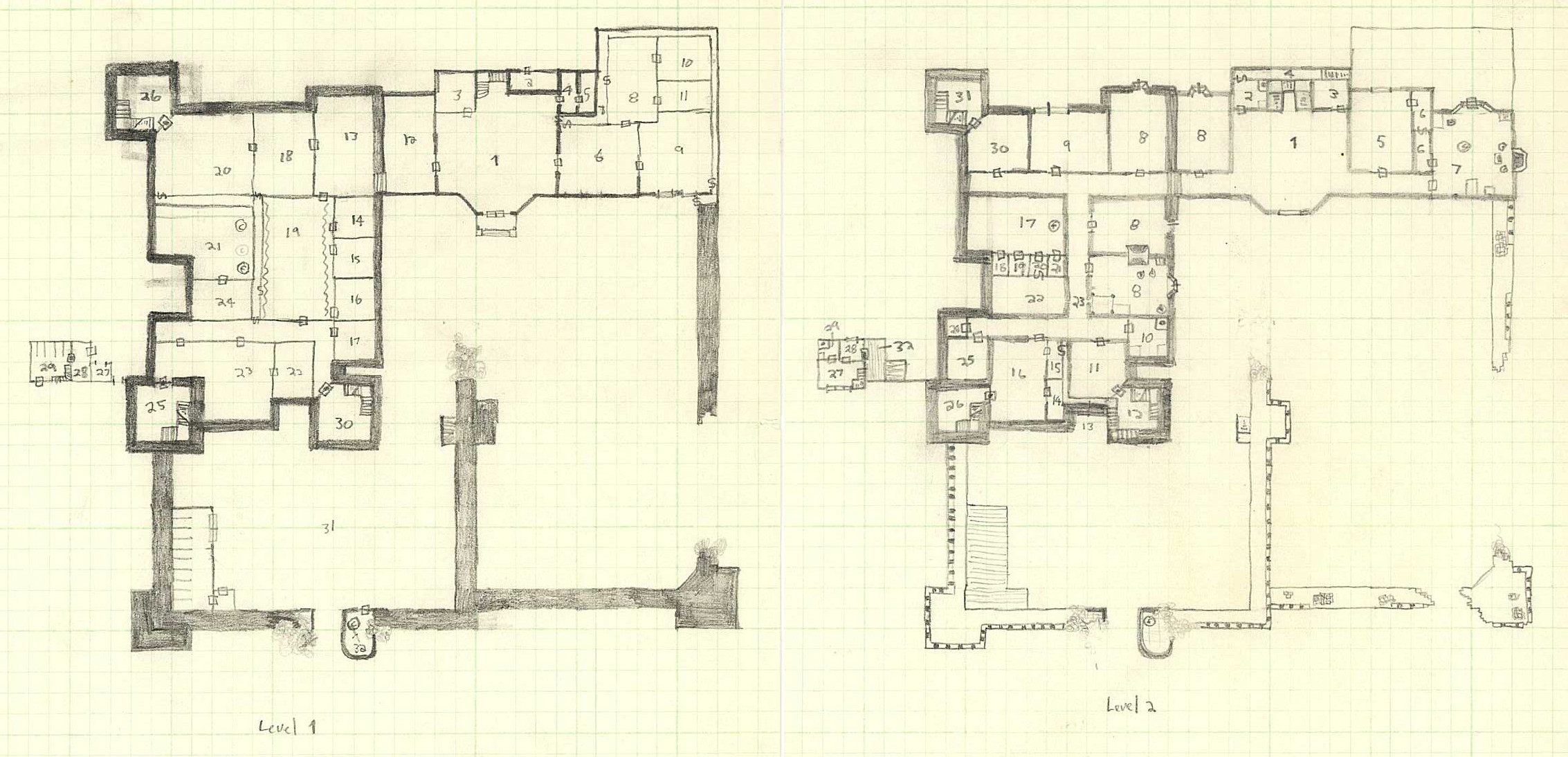
Which brings us to Pete Fenlon and his work over a decade and a half working at Iron Crown Enterprises working on their Middle Earth roleplaying game and the numerous supplements detailing parts of the world, expanding on the works of Tolkien, and creating new adventures. Many of us were inspired by his work and have so many great memories of each and every map. The Pete Fenlon style has influenced not just gamers like myself, but other map designers, as well.
Continue reading

Mapping Monday: Isometric Maps

The Magic Users’ school from Pellinore

One of the most difficult things with maps, particularly in those for roleplaying games, is capturing three-dimensional spaces. Since the early days of computer games like Colossal Cave Adventure and various dungeon delves, the result is the flattening of complex structures onto two-dimensional planes.

My experiences as an early gamer were rather insular and even TSR’s Dwellers of the Forbidden City (I1) passed me by at the time, much like many of the works out of the UK including the Pellinore game setting. As a result, I think my first exposure to isometric maps were the ones from the Dragonlance adventures and those blew my mind.

Continue reading

Mapping Monday: Designer Redmond A. Simonsen

Hex maps are a staple of games, a way of describing a chaotic surface in a way that facilitates play by abstracting that surface to a degree that’s easier and simpler than it would otherwise be. As an old-time gamer, I confess to a soft spot for hex maps, whether it’s the simplicity of the terrain as modelled in the original Panzer Blitz and Panzer Leader, or the use of hexagons to show distance in above-ground maps for roleplaying game settings like The World of Greyhawk (TSR) and The Wilderlands of High Adventure (Judge’s Guild).

At their best, hex maps combine an ease-of-use with a wealth of detail that makes them both functional as game maps while simultaneously conveying that functionality in a visually-pleasing fashion that makes clear what’s being represented.

Devil’s Den map detail by Mark Simonitch for The Three Days of Gettysburg from GMT Games

By way of example, consider the Battle of Gettysburg and the challenges it presents to a wargame designer. How best to represent key areas like Devil’s Den, an area littered randomly with boulders and trees, and overlooked by Little Round Top? The somewhat unique character of the terrain gave the struggles in that area a different feel and something to be captured on a map as something more than a rough terrain hex. The same can be said for many unique features, either specific to a particular battlefield or to a theater of operations, be it the bocage of Normandy or the factories of Stalingrad, to name but a couple.

Which brings us to Redmond A. Simonsen, one of my absolute favorite map designers whose credits span a myriad genres of wargames. I’m not sure which of his maps I fell in love with first, but most span the same era (1977-1981, the heyday of Simulations Publications, Inc. (SPI)).

Continue reading

Mapping Monday: Old Personal Maps

Decades ago, I used to draw maps. I’ve always enjoyed maps of imaginary places and I’ve drawn more than a few of my own. As much as I enjoyed drawing them, I really fell off in completing new maps or even in sketching out ideas.

For 2018, my goal is to rediscover my love of maps, to share the maps and artists who have inspired me, and to create more maps of my own along with the process from inception to completion.

Two-level map of a partially ruined castle


Continue reading

Lost in Guangzhou, or The Map is not the Territory

When I was in China last year, I spent most of an afternoon wandering the city of Guangzhou exploring the neighborhood around Yuhu Lake, an area diametrically opposite to my intended destination. I set out from my hotel with a good idea of where I was headed and figured my destination, Yuexiu Park, was so large that there was no way I could miss it. It turns out, I was wrong.

The problems began when I discovered the map I had used to initially orient myself was inadequate for the task of displaying three dimensions. In particular, the area I was headed contained hills, a multi-tier highway, a pedestrian overpass, an elevated railway with a pedestrian underpass, roads running at angles to each other, few visible landmarks, and road signs in Chinese. I’ve since educated myself further on the last point (at least to the extent of knowing Xiaobei Lu translates as Little North Road), but that still would have only helped a little.
Continue reading

Mapping Early Manhattan

The September 2009 issue of National Geographic Magazine had a fascinating article about Manhattan before it was settled. The article is based on the work of the Manahatta Project, an endeavor to match the current city to the terrain as it existed prior to settlement by Europeans and to then add the ecosystem that went with the land. The science of landscape ecology and the visualization of biosystem relations that the project has dubbed “Muir Webs” both appear to me to be narratives that go beyond single dimensions and instead look at the patterns formed.

For much the same reason, there is a similar narrative about the early settlers of New Amsterdam, among them is the story of my ancestor Jan Jansen van Flensburg. As a baker who came to the New Netherlands and raised his children in New Amsterdam, the records are far more extensive than for many other immigrants of that time and the maps well detailed (such as this 1656 map of the New Netherlands).

Seeing new ways of combining various data the way the Manahatta Project has done inspires me to look at new ways to bring together historical data and maps such that they tell a story that’s richer than the sum of their parts. A good start in this way of looking at information is the software from TimeGlider, which is useful in putting together historical events in sequence such as this history of World War I. [Update 01-12-2021:  Timeline is now defunct, but I think offerings like Preceden and Twile include similar options).

nieuwamsterdam

Newer posts »

© 2024 Gaslight & Steam

Theme by Anders NorenUp ↑