When I was in China last year, I spent most of an afternoon wandering the city of Guangzhou exploring the neighborhood around Yuhu Lake, an area diametrically opposite to my intended destination. I set out from my hotel with a good idea of where I was headed and figured my destination, Yuexiu Park, was so large that there was no way I could miss it. It turns out, I was wrong.
The problems began when I discovered the map I had used to initially orient myself was inadequate for the task of displaying three dimensions. In particular, the area I was headed contained hills, a multi-tier highway, a pedestrian overpass, an elevated railway with a pedestrian underpass, roads running at angles to each other, few visible landmarks, and road signs in Chinese. I’ve since educated myself further on the last point (at least to the extent of knowing Xiaobei Lu translates as Little North Road), but that still would have only helped a little.
As a Westerner, I tend to use Google Maps and it works fine for most places where three-dimensions isn’t an issue. But that lack of dimensionality is a weakness shared with printed tourist maps. At the time, I wish I’d turned to Baidu maps which, while sometimes being hard to read, solve the problem of dimensionality by using an isometric view rotated about forty-five degrees from north. Here’s the Google Map of the area:
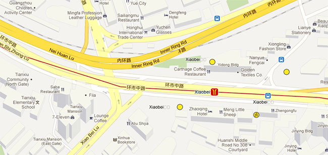
And here’s the isometric view:
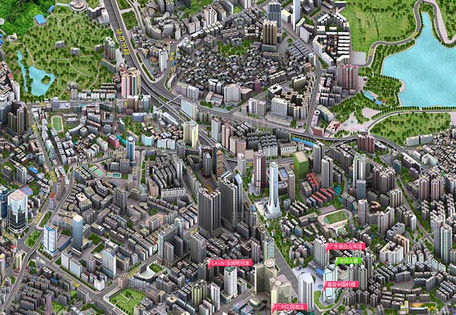
You can see where, due to the rotation, the Inner Ring Road runs off the map at the top upper left instead of the upper part of the left side. On this map, you can also see the lake at Yuexiu Park on the left and Luhu Lake at the right. Also, the elevated railroad grade on the Google Maps version totally disappears on the isometric view.
Here’s a zoomed-in version of the intersection of Xiaobei Lu and Huanshi Zhong Lu from another isometric map of Guangzhou that shows part of the railway and the pedestrian overpass more clearly:
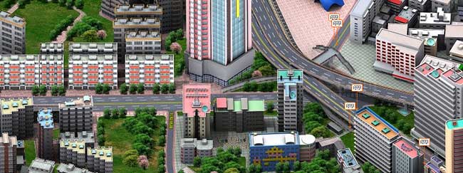
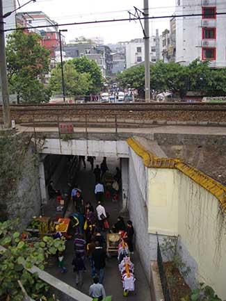
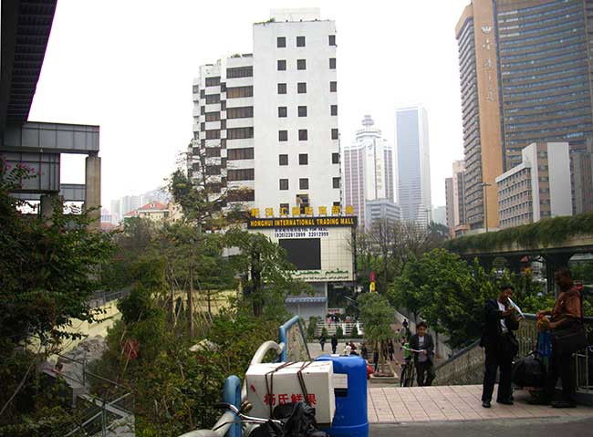
Here’s some views of the actual area so you can see how the maps fail to capture the area well. To the left is the railway underpass with an unmarked pedestrian walkway. Also, the pedestrian overpass doesn’t cross the railway. This underpass and a nearby street with sidewalk are the main means of crossing to the north at this point.
Below is the view from the pedestrian overpass that crosses both Xiaobei Lu and Huanshi Zhong Lu. In the upper left, you can also see a portion of the ring road. I believe this view is looking west along Huanshi Zhong Lu towards where it becomes Huanshi Dong Lu (towards the GDTV building and our hotel which is on Huanshi East Road).
As a visual person, it’s much more helpful to have a view from the street when navigating. I get lost much less frequently when I know what an area looks like. As a genealogist, it’s even more helpful since places change over time and one family’s graveyard quickly becomes a stand of trees in a cow pasture. I’ll share some more on navigating in China and finding obscure locations in the United States, as time permits.