One longer-running campaign I ran evolved organically over time. I’ve revisited it a few times with an eye toward running it again or, at the least, culling some of the better (and less derivative) ideas that grew out of it.
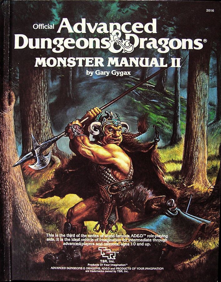
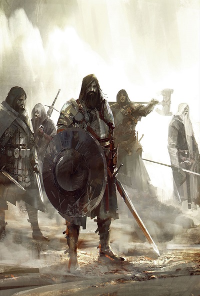
Monster Manual II cover art by Jeff Easley
The campaign began in the titular Glen with the well-worn idea that the location would serve as the home base and jumping off point for a series of adventures, much same way as TSR’s village of Hommlet. The Glen marked the northernmost outpost of a large unnamed kingdom. From there, the player characters would initially investigate rumors of a possible goblin threat that would turn out to be the harbinger of an all-out invasion. The visual inspiration for that initial foray came from Jeff Easley’s cover art for the Monster Manual II and the idea of a monster-haunted forest (much like Mirkwood as Iron Crown’s MERP setting was an influence, but rather more deciduous and slightly less dangerous à la the Trollshaws).
As I added elements to the game and the threats escalated to match the level of the characters, the Glen was quickly left behind in favor of an extended foray forever deeper into the lands where evil forces had gained a far greater foothold than anyone imagined. The idea of locations linked by a larger story arc obviously drew in great deal from the Giant and Drow series, but taking place almost entirely overland and sharing far more with the Dragonlance series. I was also inspired by the military campaign style of Glen Cook’s Black Company series that first came out at that time.
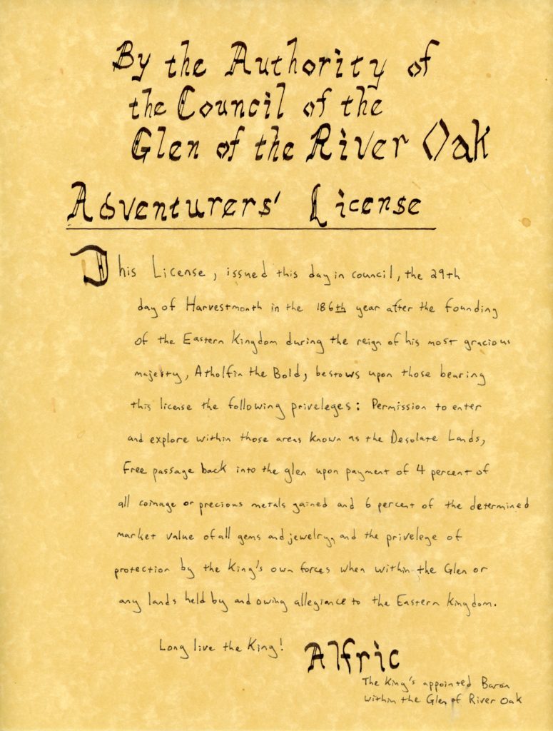
Adventurers’ License One of the first player handouts of the game
In a previous post about a long-running Gamma World campaign of mine, I discussed the characters traveling eastward to confront rising threats there. I had plans for a further stage of that campaign that never came to fruition where the looming threat becomes a direct confrontation in a race to uncover sites of the Ancients.
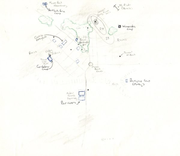
I thought that I had only planned that part and forgotten that I had done a great deal more planning and mapping until I uncovered a stash of old gaming material in my mom’s attic. As I scan and organize that material, here’s a couple of maps I made.
The first of these was from around the time the campaign ended. Different groups have converged on the ruins of what was previously the city of Provo in search of key information to the location of an ancient site. The characters may interact with allied groups like the Deathgroup and the Confederat, while competing with the Darklands force and the Wasteriders members. Meanwhile, the inhabitants of Provo, a well-fortified group of carrin control the area from their eyrie apart from a group of mutants calling themselves Batcavers who are powerful enough to oppose the carrin overlords from their underground tunnels.
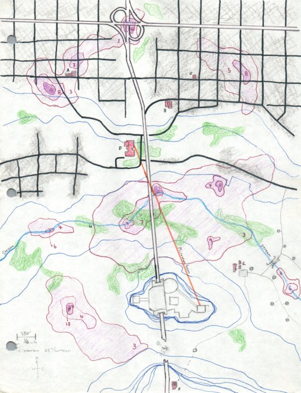
I also conceived the central fortress of the Darklanders, based heavily on the art from the cover of TSR’s Gamma Base adventure (GW8). This location wasn’t intended as somewhere the characters would travel to, being rather like Barad–dûr in Middle Earth.
I wish I had made more maps like the above to cover the various bases and staging areas of the Darklander invasion forcers. Among other things, it’s interesting to conceptualize what sort of support and Ancient technology would be needed for the terraforming machines that I planned as part of the invasion’s vanguard.
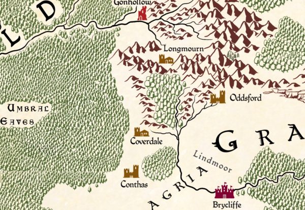
After over a year of not updating this site and giving it up for lost, I’m returning with a vengeance. Putting together map posts is a way of organizing my thoughts, but it’s also easy to go down rabbit holes. That’s what happened as I began researching settlement patterns and trade routes. Looking at medieval resource distribution led to researching tin mines led to trying to figure out trade routes in the Flanaess and things devolved from there.
I still plan to organize all that material here along with some other fun stuff I’ve looked at for itineraria and travel maps. At the same time, I recently reacquired a whole batch of old gaming material. It includes more Gamma World material and a long-running D&D campaign I ran that I’m eager to share.
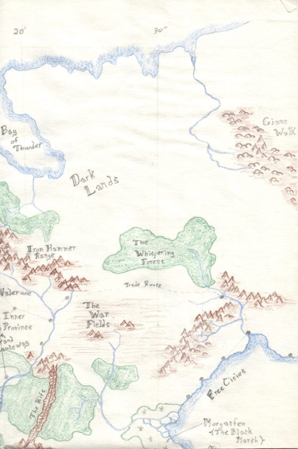
Until then, here’s a portion of an old world map I made. I won’t claim the place names are terribly original and I never developed it further, but I had fun drawing it and experimenting with map styles (I even included meridian lines!)
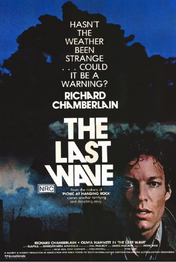
Seattle is a film city with a tradition of arthouse venues and the Seattle International Film Festival (SIFF). It was at the Harvard Exit on Capitol Hill that I saw my first double feature (at least, as far as I can remember). The two films were Walkabout and The Last Wave, two Australian films that both featured actor David Gulpilil. As kids (circa 1979-1980), my brother and I found Walkabout bewildering and bleak, so much so that, despite the lateness of the hour, we convinced our parents to let us stay up late to see The Last Wave. I think my fondness for Australian films, the weirder the better, comes from seeing that second movie. I’ve since watched Picnic at Hanging Rock, Incident at Raven’s Gate (released in the States as Encounter at Raven’s Gate), The Adventures of Priscilla, Queen of the Desert, and all of the Mad Max Films, among many others.
From my experience, that remains my quintessential double feature. I think there’s an art to the double feature that goes beyond the basic idea of watching two films of the same genre or from the same director. Those sorts of double features can be served up by a machine algorithm and aren’t that exciting. The films in a double feature should have certain things in common, be it genre or atmosphere, often making picks by the same director easy (I’d feel comfortable pairing any two earlier Wong Kar-Wai films together, in part because his films achieve their striking visuals from his collaborations with Christopher Doyle, but less so with the works of the Coen Brothers). Most of the films I would put together are at that middling state where they complement each other while providing just enough contrast to surprise. I’m not enough of a film enthusiast to come up with combinations that I feel are truly sublime combinations, being more the kind of dullard who would pair The Draughtsman’s Contract with Barry Lyndon, or maybe one of those with Brotherhood of the Wolf, and all because of the period costumes (the latter two for some sort of 18th century cohesiveness works better with that reasoning). For that reason, these are my “Dad Double Features”, not overly adventurous, fun for the family, with something that stands out for me.
In creating this list, I discovered that the cinematography for Rabbit-Proof Fence was by none other than Christopher Doyle with a soundtrack by Peter Gabriel, who composed the brilliant music for The Last Temptation of Christ. I’ve been remiss in not watching it sooner. In the meantime, let’s start with these five pairings of some of my favorite movies.
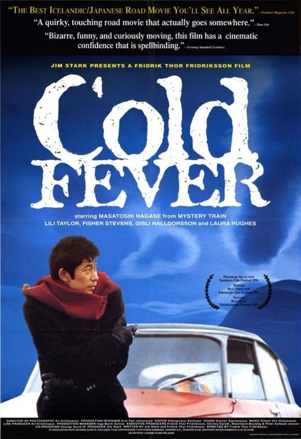
Cold Fever (IMDB | Wikipedia) / The Last Wave (IMDB | Wikipedia) Why these two: These films both present cultures from the point of view of outsiders using visuals that juxtapose the real world with nearly fantastic elements. In the former, an encounter with a pair of Americans is counterpointed by the otherworldly girl who restarts his car, while the latter plays the courtroom elements with against mysterious owls and visions of the city drowning.
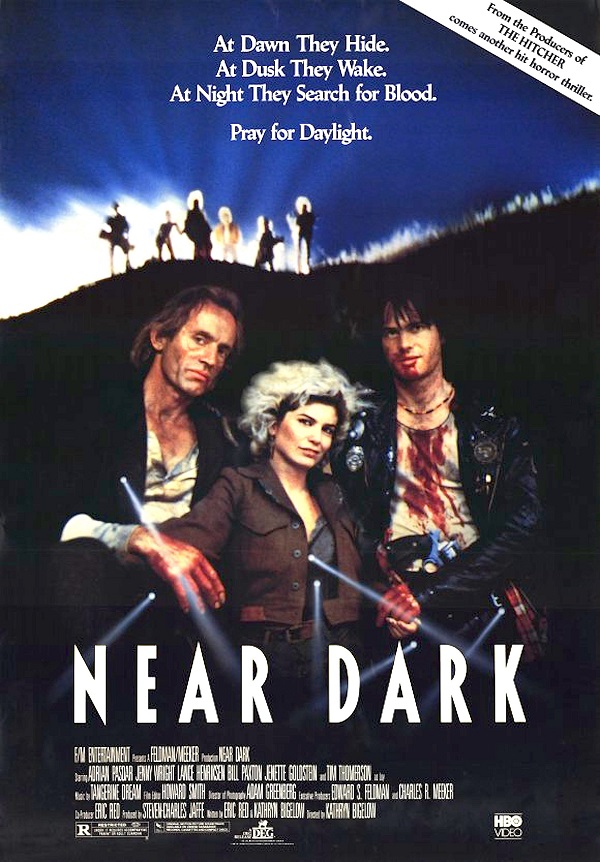
The Lost Boys (IMDB | Wikipedia) / Near Dark (IMDB | Wikipedia) Why these two: Two vampire movies, one humorous and one, well, dark. They both seem to have every trope you can think of, with The Lost Boys representing pretty much peak “brat pack” in a teen movie with campy adventure, while the other is Bill Paxton at his best in a road movie that hits all the right vampire movie notes. It’s worth noting that Near Dark is extremely different from Katheryn Bigelow’s subsequent films (Blue Steel and Point Break would pair terribly with Near Dark)
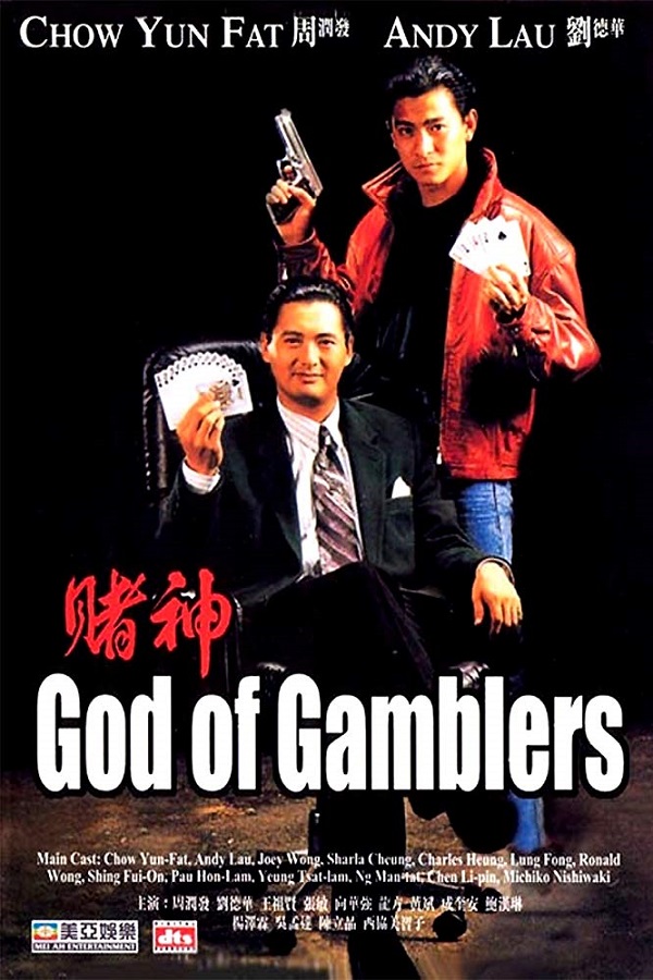
Time and Tide (IMDB | Wikipedia) / God of Gamblers (IMDB | Wikipedia) Why these two: The charisma of the stars, particularly Wu Bai and Chow Yun Fat, paired with their younger counterparts, both directed by Hong Kong directors at the top of their game in action-packed adventures. I love Hong Kong action and the fight scene during a hurricane in Time and Tide is only one of many stand out elements. God of Gamblers also has great action scenes, but as a New Year film, it mixes in equal parts comedy and romance also.
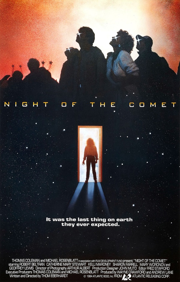
Night of the Comet (IMDB | Wikipedia) / The Quiet Earth (IMDB | Wikipedia) Why these two: Both of these movies imagine a world where everyone seems to have mysteriously disappeared. Investigating what happened is the basis of the plot in each case, with very different stories. Night of the Comet was an influence on the Buffy the Vampire TV series and the opening on the vacant streets of LA are eerily reminiscent of the deserted London in 28 Days Later. The Quiet Earth has similar visuals and plays with the themes of vacancy and loneliness, but is far more elegiac than horror-filled.
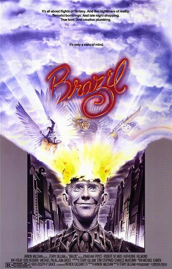
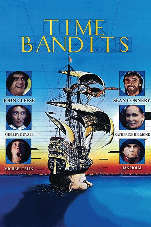
Brazil (IMDB | Wikipedia) / Time Bandits (IMDB | Wikipedia) Why these two: Tonally very different, these films are both wonderfully weird. Brazil is a dystopian future with fantastic elements, while Time Bandits is a dysfunctional universe that, apart from the dimension-traveling is conversely more grounded than Brazil. Both feature quirky characters with the map-wielding dwarves (the titular bandits of the movie) knowing way too much about the world underlying the one we perceive, while being far more inept than the Brazil’s repairman, Harry Tuttle. Both movies display director Terry Gilliam’s brilliance who, when he succeeds, he’s magnificent.
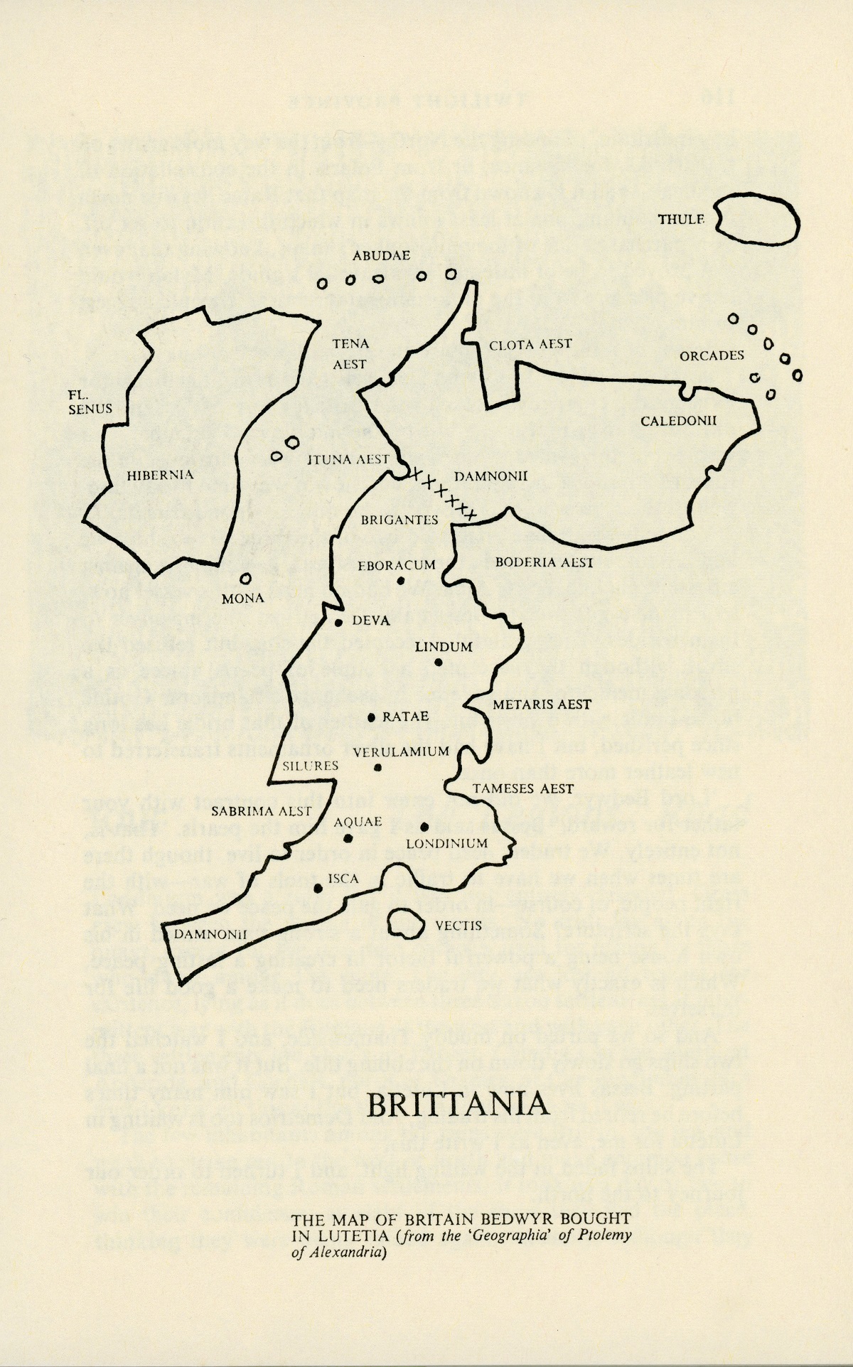
Most of the retellings of Arthurian legends that I’ve read are set in southern England or Cornwall. George Finkel’s Twilight Province is set primarily in the northern part of Britain just past Cataractonium (now Catterick in Yorkshire). Additionally, the story is narrated from the point of view of Bedwyr much like Gillian Bradshaw’s Hawk of May is told from the point of view of Gwalchmai ap Lot (AKA Gawain).
Fortunately, Twilight Province includes several detailed maps, but also includes a map Bedwyr purchases while abroad. He says this about the map:
“While a map is not an infallible guide to a traveller, in a strange country it is better than no guide at all. If it does not show the distance between one place and another, at least it shows their relationship regarding direction. Since there are ways, know to every boy in Britain, of finding the North — from the way moss grows on tree-trunks, for instance, or from Polaris in the constellation of the Bear — and it is known from the map that Ratae lies due north of Veralamium [sic], one at least knows in which direction to set off.” – pages 114 and 116
When Dungeon Adventures first started publication and I set my sights on publishing an adventure with that magazine not long after. I had played TSR’s Oriental Adventures in college and had run FGU’s Bushido, so the logical dovetailing of these experiences with my Japanese Studies degree was to write an adventure using the OA setting. In due course, the editors at Dungeon Adventures responded to my query letter with the green light to submit a full-length adventure for their consideration.
The adventure I authored, The Lost Temple of Takako Province, was… not great. Looking back at a remove of several decades, it’s pretty clear to me some of the major reasons that the editors rejected it. It wasn’t badly written and the map I created was quite serviceable. It was just rather lackluster. It lacked depth, it didn’t tell a compelling story, the playing time was short compared to the length of the adventure, and it failed to build any sense of suspense.
What I wrote pre-dated some of the influences that I would have happily drawn on. For example, there’s a scene in Koji Suzuki’s novel Ring (Ringu) where the main characters visit the holiday resort together to find the well where Sadako is buried. The atmosphere of the setting combined with the culmination of the investigations is deeply unsettling. Had I had the opportunity to read material like that, finding the temple would have been part of the adventure and the approach there the culmination of that investigation rather than the adventure starting point.
If I had done more research, I would have learned much more about youkai instead of just relying on the prevalent bakemono and their kin as they existed in the rulebook. The ultimate enemy the group was to encounter was a goblin spider, a rather lackluster choice, though I chose it for an appropriate Challenge Rating and it’s mimicry abilities. The inhabitants of the temple building should have been an opportunity to introduce a few new creatures that would have rounded out the atmosphere and kept the characters off-balance on how to deal with the final encounters. The flow of the adventure was fairly linear with the players getting to the main temple after contending with some somewhat treacherous terrain and a few random encounters. The interior of the temple was a fairly standard sweep-and-clear with encounters varying based on how stealthily or quickly the adventures made their way through it. Overall, I think my inspiration for the flow was the TSR adventure Secret of the Slaver’s Stockade (A2), which remains a favorite of mine to this day, but not the best template for the adventure I wanted to create.
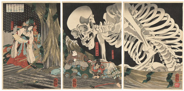
The book Anno Dracula – One Thousand Monsters by Kim Newman is what got me really thinking about this old work of mine. Quite simply, Oriental Adventures was a mess of different Asian cultures and some very confusing generalizations. Many things were simplified or dropped in order to be playable in the D&D game system. Other systems weren’t much better with the likes of FGU’s Land of the Rising Sun where the creatures feel more like reskinned versions of the beasts and Arthurian creatures from the Chivalry & Sorcery. Part of it is an issue of time period where newer eras are grafted on to an older time and part is an issue of the same failure I made which is to research the setting in sufficient death. So whereas Bushido classes youkai as apparitions and, therefore, a sub-category of yurei (ghosts), I think the consensus is that youkai is a catch-all for every kind of strange creature, be it ghosts, bakemono, kami, or animate objects in the sense the term was used during the Edo Period. Which is certainly reasonable if you’re incorporating something like Le Morte d’Arthur into your pseudo-European fantasy campaign. I think it would be great to run adventures with a flaming cart wheel or a giant skeleton.
Mitsukuni Defying the Skeleton Specter Invoked by Princess Takiyasha by Kuniyoshi. This art is cited as the inspiration for the Gashadokuro
At one time, it seemed like most fantasy novels came with maps. Not the highest quality maps since they were printed on cheap paper on a page size that greatly limited the amount of detail allowed. Everything from Fritz Lieber’s Faffhrd and the Grey Mouser books to Anne McCaffrey’s Dragonriders of Pern and Hugh Walker’s Magira series featured maps of fully-realized worlds. Even if many of the locations were never visited by the characters, they were mentioned in passing and existed as part of a larger setting.
Kings of the Wyld cover art by Richard Anderson
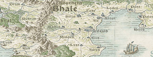
In this modern digital age, I’ve been reading more books in digital format and the focus seems to be less on the extras that are part of a physical book. The Amazon Kindle reader skips right past the cover and acknowledgements to the opening of the first chapter. When I started reading Kings of the Wyld by Nicholas Eames, I was drawn in by the characters and the setting. I was thinking the book would be very much in line with Joe Abercrombie’s First Law trilogy or something very much in the vein of other books best described as grimdark, which is not my favorite sub-genre, but very enjoyable in the proper mood. Kings of the Wyld is something very different in a way I can’t quite quantify, much more an epic retelling of a grimdark Dungeons and Dragons campaign that started out in college and then sat on the shelf for a couple of decades before the characters were brought back from retirement for one last gig. The book literally takes the idea of getting the band back together like an aging rock band and runs with it.
<Portion of Kings of the Wyld world map in color as rendered by Tim Paul
Naturally, with a setting like this, I became curious whether there was a map since none was included in the e-book I was reading. Even a fan-made map is enjoyable and well-made ones have a way of becoming canon or otherwise enhancing the reader’s experience. At least, that’s true for me. What I found instead was the author’s website with maps that included the author’s original hand-drawn map, illustrations, a soundtrack, and more. Increasingly, the web has opened up new vistas where authors can expand on their creation in ways that the limits of physical and digital books cannot, much to the delight of fans like myself.
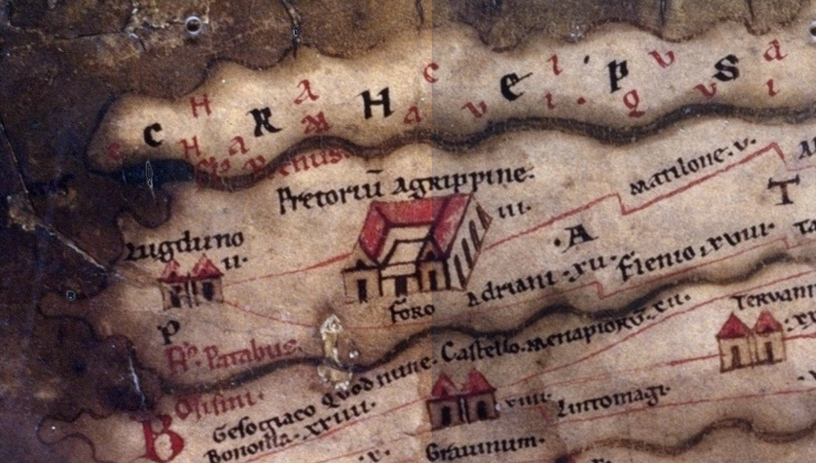
Most commonly, when we think of maps today, we think of detailed maps showing places in relation to each other geographically. Just as useful and more common in times gone by were illustrated itineraria or maps showing the relation between points along a journey. Maps such as those of Matthew Paris and his Stationes a Londinio ad Hierosolymam (Itinerary to the Holy Land) were of particular use to pilgrims. One of the most famous of these ancient iteneraria is the Roman Tabula Peutingeriana or Peutingerian Table showing travel routes between locations in the Roman Empire.
Detail from Tabula Peutingeriana, Section 1: Germania Inferior and Batavia
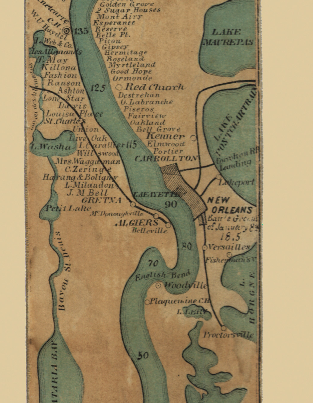
Compare this to the 1866 map of the Mississippi River by Coloney and Fairchild, dicussed in this article. It’s fascinating to see the Mississippi River with all of its bends and turns straightened horizontally in a way that preserves the feel of the river and its major landmarks, while rendering it on a relatively narrow ribbon. The full Coloney and Fairchild map at the library of congress is recommended for the greatest detail.
New Orleans detail from Ribbon map of the [Fa]ther of Waters by Coloney and Fairchild, 1866
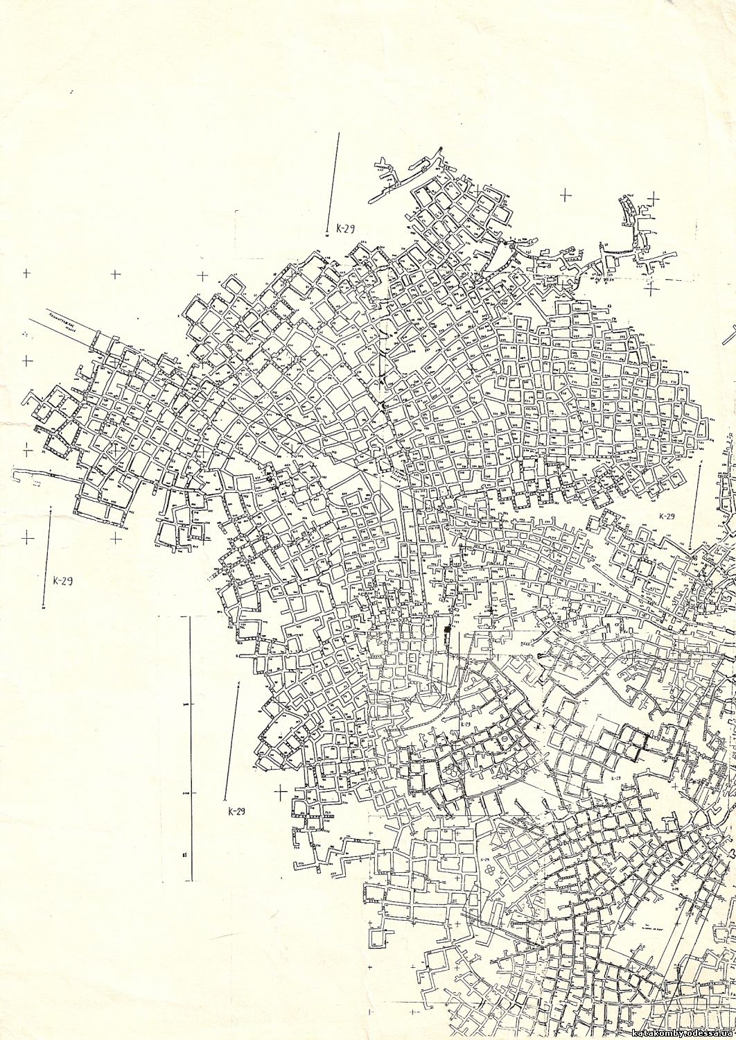
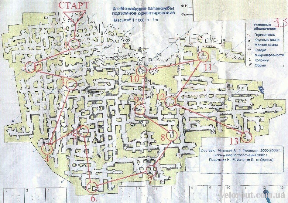
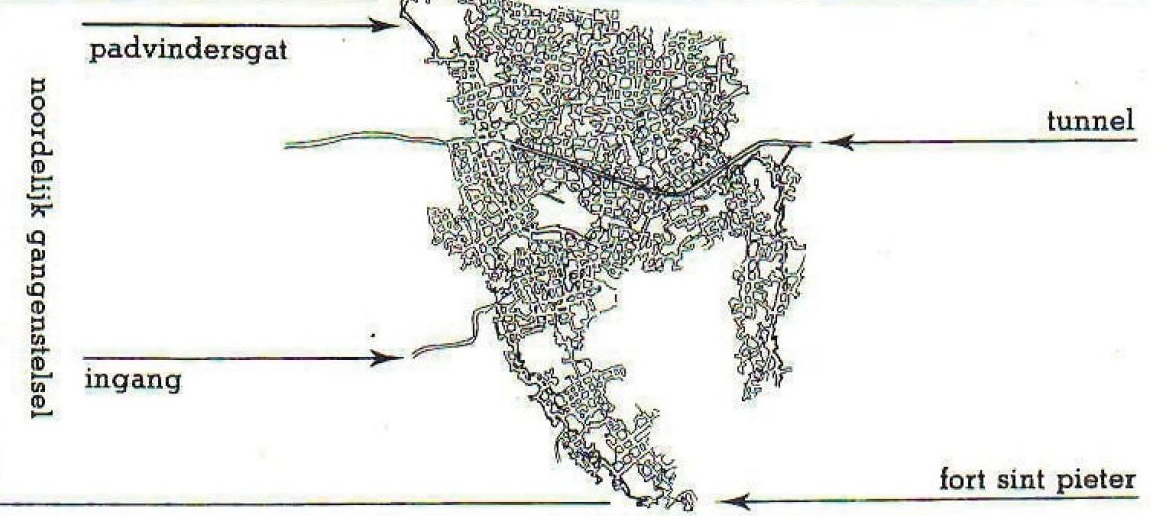
If you’re like me, you’re familiar with the Paris catacombs. They’re not the only such network of tunnels and many exist all over the world. Unlike limestone caverns, which are formed through the natural actions of nature, a large number of these tunnels were expressly for the purpose of mining limestone for the use of construction. As a result, they occur alongside populated areas like Paris, Maastricht, and Odessa.
An article in the Atlas Obscura discussed the entry for the Odessa Catacombs. Like the Paris catacombs, they were used to extract limestone, though apparently of a somewhat more recent vintage, dating back to the 1600s and with the greatest activity in the 1800s.
That anachronism aside, any section of the catacombs might be used by a gamemaster looking for a subterranean map. Even that might not be a stumbling block, given how many high-fantasy settings are littered with buildings owing more to the likes of Neuschwanstein Castle than to early medieval castles.
The Gaslight and Steam website is my place for various musings and experiments. Most of the things you'll find here are related to tabletop RPGs, video games, and movies. I also go on about my fascination with maps, particularly as it relates to the previously mentioned topics. This blog is maintained by David Bennett.