As a long-time fan of post-apocalyptic fiction and continuing last week’s discussion of toponyms, I thought I’d toss out three maps of the County of Kent in England. They’re very from very different time periods and the features on each are also dissimilar, but they’re all recognizable of the same area.
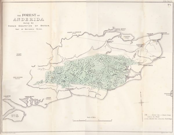
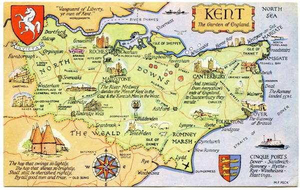
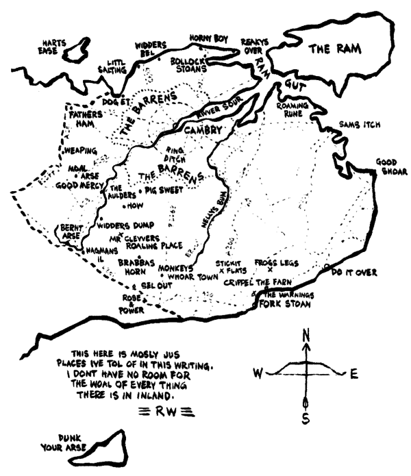
The first map is of Kent during the Roman occupation (and also covering Sussex, Surrey, and neighboring areas) that shows the extent of The Weald at that time (also known as Coit or Coed Andred, Silva Anderidae, or Andred’s Wood). Very little remains now apart from small forests like Ashdown Forest at the center of the High Weald and, incidentally, the basis for the setting of Winnie the Pooh stories. The second map is a postcard map of modern Kent (via Alwyn Ladell) that shows The Weald in the lower left. The third map is a future England as imagined by Russell Hoban for his book, Riddley Walker where the place names combine language drift and folk etymologies (or “eggcorns”). The place names are still recognizable in all three despite the changes in name over time.
As a case in point, all three maps feature the port city of Dover. On the first, it appears as Portus Dubris, a latinised name derived from the name given by the locals and meaning something like “river port” or “deep water port” (in the sense of the word “water” deriving from the root “deep”). The modern map features its present name, which is closest to the French name (Douvres). The imaginary future maps renders it as Do It Over, a curious expansion as a folk etymology like many other place names similar split and expanded in the book. The key in the map of the future is that it’s logically consistent with how names evolved from the names in the past.


