The portfolio and blog of David Bennett

Month: June 2018

Mapping Monday: Travelers’ Maps and Itineraria

Most commonly, when we think of maps today, we think of detailed maps showing places in relation to each other geographically. Just as useful and more common in times gone by were illustrated itineraria or maps showing the relation between points along a journey. Maps such as those of Matthew Paris and his Stationes a Londinio ad Hierosolymam (Itinerary to the Holy Land) were of particular use to pilgrims. One of the most famous of these ancient iteneraria is the Roman Tabula Peutingeriana or Peutingerian Table showing travel routes between locations in the Roman Empire.

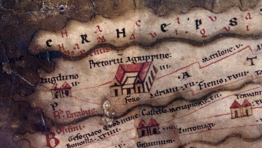
Detail from Tabula Peutingeriana, Section 1: Germania Inferior and Batavia

Here’s a different view of the same Peutingerian Table that sacrifices some of the feel of the original in favor of ease of usability and greater legibility.

Compare this to the 1866 map of the Mississippi River by Coloney and Fairchild, dicussed in this article. It’s fascinating to see the Mississippi River with all of its bends and turns straightened horizontally in a way that preserves the feel of the river and its major landmarks, while rendering it on a relatively narrow ribbon. The full Coloney and Fairchild map at the library of congress is recommended for the greatest detail.

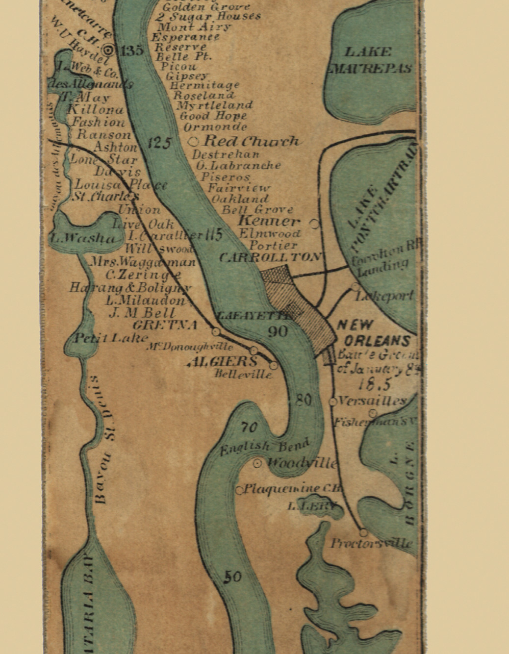
New Orleans detail from Ribbon map of the [Fa]ther of Waters by Coloney and Fairchild, 1866

Mapping Monday: Limestone Catacombs

If you’re like me, you’re familiar with the Paris catacombs. They’re not the only such network of tunnels and many exist all over the world. Unlike limestone caverns, which are formed through the natural actions of nature, a large number of these tunnels were expressly for the purpose of mining limestone for the use of construction. As a result, they occur alongside populated areas like Paris, Maastricht, and Odessa.

An article in the Atlas Obscura discussed the entry for the Odessa Catacombs. Like the Paris catacombs, they were used to extract limestone, though apparently of a somewhat more recent vintage, dating back to the 1600s and with the greatest activity in the 1800s.

That anachronism aside, any section of the catacombs might be used by a gamemaster looking for a subterranean map. Even that might not be a stumbling block, given how many high-fantasy settings are littered with buildings owing more to the likes of Neuschwanstein Castle than to early medieval castles.

Odessa Catacombs section via http://katakomby.odessa.ua/

Ak-monaya Quarry in the Crimea via this overview

A portion of the Sint-Pietersberg limestone quarry in the Netherlands via student thesis by Sara Everaarts

© 2024 Gaslight & Steam

Theme by Anders NorenUp ↑