The portfolio and blog of David Bennett

Month: January 2018

Mapping Monday: Designer Pete Fenlon

The maps of Middle Earth have always held a special place with me, whether it’s been the original maps by J.R.R. Tolkien himself, the version by Pauline Baynes from the calendar that I owned once upon a time, or the detailed maps by Karen Wynn Fonstad that appeared in her Atlas of Middle Earth. The idea of a world with depth and history is always appealing and I must have explored every corner of the world, not only following the path of the Fellowship, but also the places mentioned in the stories or shown on the maps that were peripheral to the saga.

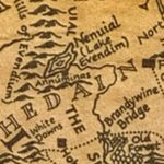
Lake Evendim and surrounds from the map by J.R.R. Tolkien

Of particular note was the lost kingdom of Arnor and the remains of its capital city, Annúminas, on the southern shore of Nenuial, also known as Lake Evendim. This is, without a doubt, my single most favorite place in Middle Earth. As the ruins of a once-great city, it barely merits a footnote in the story apart from being a special place to the Rangers of the North, the descendents of the northern Dúnedain.

Which brings us to Pete Fenlon and his work over a decade and a half working at Iron Crown Enterprises working on their Middle Earth roleplaying game and the numerous supplements detailing parts of the world, expanding on the works of Tolkien, and creating new adventures. Many of us were inspired by his work and have so many great memories of each and every map. The Pete Fenlon style has influenced not just gamers like myself, but other map designers, as well.
Continue reading
Mapping Monday: Isometric Maps

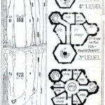
The Magic Users’ school from Pellinore

One of the most difficult things with maps, particularly in those for roleplaying games, is capturing three-dimensional spaces. Since the early days of computer games like Colossal Cave Adventure and various dungeon delves, the result is the flattening of complex structures onto two-dimensional planes.

My experiences as an early gamer were rather insular and even TSR’s Dwellers of the Forbidden City (I1) passed me by at the time, much like many of the works out of the UK including the Pellinore game setting. As a result, I think my first exposure to isometric maps were the ones from the Dragonlance adventures and those blew my mind.

Continue reading

Mapping Monday: Designer Redmond A. Simonsen

Hex maps are a staple of games, a way of describing a chaotic surface in a way that facilitates play by abstracting that surface to a degree that’s easier and simpler than it would otherwise be. As an old-time gamer, I confess to a soft spot for hex maps, whether it’s the simplicity of the terrain as modelled in the original Panzer Blitz and Panzer Leader, or the use of hexagons to show distance in above-ground maps for roleplaying game settings like The World of Greyhawk (TSR) and The Wilderlands of High Adventure (Judge’s Guild).

At their best, hex maps combine an ease-of-use with a wealth of detail that makes them both functional as game maps while simultaneously conveying that functionality in a visually-pleasing fashion that makes clear what’s being represented.

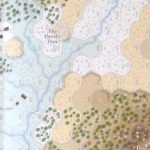
Devil’s Den map detail by Mark Simonitch for The Three Days of Gettysburg from GMT Games

By way of example, consider the Battle of Gettysburg and the challenges it presents to a wargame designer. How best to represent key areas like Devil’s Den, an area littered randomly with boulders and trees, and overlooked by Little Round Top? The somewhat unique character of the terrain gave the struggles in that area a different feel and something to be captured on a map as something more than a rough terrain hex. The same can be said for many unique features, either specific to a particular battlefield or to a theater of operations, be it the bocage of Normandy or the factories of Stalingrad, to name but a couple.

Which brings us to Redmond A. Simonsen, one of my absolute favorite map designers whose credits span a myriad genres of wargames. I’m not sure which of his maps I fell in love with first, but most span the same era (1977-1981, the heyday of Simulations Publications, Inc. (SPI)).

Continue reading

Mapping Monday: Old Personal Maps

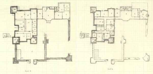
Decades ago, I used to draw maps. I’ve always enjoyed maps of imaginary places and I’ve drawn more than a few of my own. As much as I enjoyed drawing them, I really fell off in completing new maps or even in sketching out ideas.

For 2018, my goal is to rediscover my love of maps, to share the maps and artists who have inspired me, and to create more maps of my own along with the process from inception to completion.

Two-level map of a partially ruined castle


Continue reading

© 2025 Gaslight & Steam

Theme by Anders NorenUp ↑